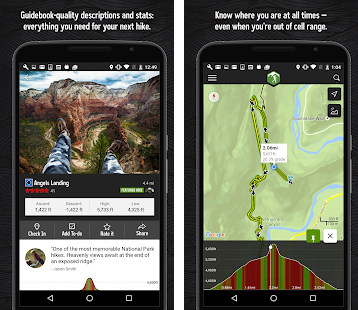
Thanks to latest technology, now we can get trail maps on iPhones and Androids so that you are confident that you will not be lost on your way to adventure.
Here is the list of best hiking apps
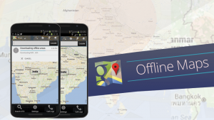
These apps also give you effective offline features. You can see the maps downloaded even when you don’t have access to the internet. They give you accurate terrain information with great attention to detail. You can see the mountains, hills, and valleys clearly. You can surf the App Store and the Google Play Store yourself to find the newest Useful hiking apps. If you don’t have a lot of time, just leave it to us! Team Phoneworld has investigated the popular GPS tracker apps that have helped many Hikers to find the right way this year. So here is the list of best hiking apps, which will add to your experience of adventurous hiking trip without the worry of getting lost on your way. Below list includes best hiking apps for Android and Best Hiking Apps for iOS users.
List of 12 Best Hiking Apps for Android / iOS (2023)
1.Map My Hike GPS Hiking
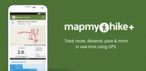
Now you can Track and Map every hike with this app, named, MapMyHike. This App also gives its feedback and stats. so that you can easily improve your performance. It lets you discover new workout routes. You can also save and share your favourites with this app to be inspired to reach new hiking goals. Whether you’re a starter on your first long hike or a pro, you will find every feature that you need to stay on the track.
This is the best app for Android and iOS users who want an app to track their weight loss. With MapMyHike, one can also share their hiking experience with other hikers. This is the best way of remaining motivated and active. To get the best results with this app, follow the following steps:
Track and Map your Workouts Connect with Apps and Wearables Join the Community Train like a Pro with MVP Premium Features
To download Map My Hike GPS Hiking on Android, click Here. To download Map My Hike GPS Hiking on iOS, click here.
2. AllTrails:
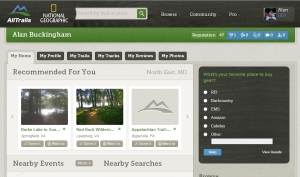
Now Discover the outdoors with AllTrails App. Explore hiking, biking, and running trails around the world. Sve your hiking, running or mountain bike experience with the app’s GPS activity tracker. You can also download offline maps, get to the trailhead and start your outdoor adventure. This is the most accurate GPS hiking app.
With this app, one can easily explore national parks or discover new cycling, running and hiking trails in your area. Whether it’s a hike or a cycling ride you’re after, AllTrails inspires you with trail maps for your next outdoor adventure. With hiking trails:
Explore 50,000+ Hiking Trails and Mountain Bike Routes Record Your Outdoor Adventures with the AllTrails GPS Activity Tracker Save Your Favorite Trails Get GPS Driving Directions to the Trailhead
To download the AllTrails App on Android, click Here. To Download AllTrails App on iOS click here.
3. Gaia GPS:
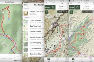
Plan trips and stay safer in the woods, with Gaia GPS. Download this app for offline usage of maps. You can explore trails, and use a complete GPS toolkit for hiking and other adventures.
By using Gaia GPS for work and play, one can join thousands of hikers, backpackers, hunters, offroaders, mountain bikers, backcountry skiers, firefighters, guides, and other serious outdoor adventurers and professionals that use. To download the Gaia GPS, click Here. To Download Gaia GPS click here.
4. Weather Live:
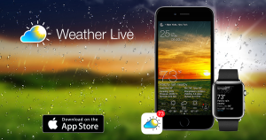
The Weather Live app is an app available for both iOS and Android. It is a wonderful app functionally. The app is fully customizable just according to your choice. With Weather Live, you can check the weather around you and all over the world at a glance. One can also adjust their schedule according to the weather coming in. For weather updates, you don’t have to look outside, as the app will make you feel like you are already outside.
This accurate weather app allows to find out a detailed forecast wherever you are, for any time of the day or for the next 7 days just by tapping on the icons: – Current and “Feels like” temperature – Wind speed and direction – Pressure and precipitation information – Sunrise/sunset time – Weather Radar & Rain maps and other useful weather data accompanied by live animations and graphics. To download the Weather Live on Android, click Here. To Download Weather Live on iOS click here.
5. OS MapFinder
The MapFinder app is for customers to use and access their purchased map tiles but sadly will not be updated with new features.
The good thing about OS Maps app is that it allows customers to download a digital version of their paper map to view and subscribe to see all of the GB Ordnance Survey maps. OS MapFinder includes: • A free overview of Great Britain at 1:250 000 scale • Free road maps down to street level • Options to buy high-resolution OS Explorer and OS Landranger maps • Route recording and planning tools – record your routes in real time • Route import and export functions • Time, distance, OS grid references, latitude and longitude • Select a route, see how long it will take on average to walk • Place name look-up – postcodes and places in Great Britain • Ordnance Survey grid reference look-up • And useful tips on how to read and navigate maps To download the OS MapFinder on Android, click Here. To Download OS MapFinder on iOS click here.
6. ViewRanger
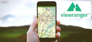
Discover inspiring trail guides, download offline maps, and navigate with confidence on your next hike, bike ride, backpacking trip, or outdoor adventure. Now you can go anywhere without worrying about net facility ViewRanger works offline without mobile and data signals.
Download offline maps onto your phone before you leave home. Then explore off-the-grid, even without cell coverage. To download the ViewRanger on Android, click Here. To Download ViewRanger on iOS click here.
7. Peak Finder:
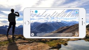
The mountains are calling! Peak finder app is for Mountain Lovers basically. Explore more mountains than any mountaineer! PeakFinder Earth makes it possibl and shows the names of all mountains and peaks with a 360° panorama display. This functions completely offline – and worldwide!
PeakFinder knows more than 350’000 peaks – from Mount Everest to the little hill around the corner. To download the Peak Finder on Android, click Here. To Download Peak Finder on iOS click here.
8. Chimani National Parks app:
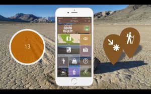
The Chimani National Parks app contains details on National Park Service, including national parks, monuments, seashores, historic sites, and more.
The app includes a photo gallery with hundreds of images, and the ability to collect badges and earn points for each of the parks you visit. Key features of Chimani National Parks include:
Simple Interface: Chimani’s menus are based on universal national park symbols. Details: Descriptions of each park’s key features and history, with links to additional information resources. Map: View the location of each park on an interactive map. Search: Use our lightning-fast search engine to quickly find information on each park. Badging System: Keep a symbolic record of each park you visit and earn points for registering a visit. Someday/Maybe: Create a list of the parks you plan to visit in the future.
To download the Chimani National Parks app on Android, click Here. To Download Chimani National Parks app on iOS click here.
9. Google Maps Offline
• Beat traffic with real-time ETAs and traffic conditions • Catch your bus, train, or ride-share with real-time transit info • Save time with automatic rerouting based on live traffic, incidents, and road closures To download the Google Maps Offline on Android, click Here. To Download Google Maps Offline on iOS click here.
10. Cairn:
Cairn helps you get home safely from any outdoor adventure. Easily share your plans with loved ones, download offline topo maps, see stats on your route, record your hiking trail and find spots with cell coverage.
Recently named one of the 10 best apps for the outdoors by Backpacker Magazine. To download the Cairn on Android, click Here.
11. FarOut Guides:
Guthook Guides is one of the most widely used smartphone app for long-distance hiking. It is a go-to for thru-hikes like the Pacific Crest Trail or the Appalachian Trail since its database has more than 35,000 miles of routes. In actuality, it was created by previous thru-hikers who saw the necessity for a trustworthy offline map. You may examine the app’s extensive route information on topographic or satellite maps, including the path’s length, elevation, waypoints, water sources, and campsites. To ensure that you’re constantly on the route, the app actively records your location on the map. Everything here functions without mobile service and offline. The app itself is free, but you have to pay for each trail separately. Buying comprehensive trail guides for through-hikes or smaller trail guides for national parks are also options. The price of the guides varies by route length. To download FarOut Guides Offline on Android, click Here. To download FarOut Guides Offline on iOS, click here.
12. Hiking Project:
This crowdsourced hiking app is also an excellent source of motivation. While Hiking Project shares many features with other apps, it also offers sites of interest, which the app refers to as “Gems.” You may look for hikes by location, place of interest, or hike characteristics. Hiking Project allows you to view statistics by state, including trails sorted by popularity, with treks mostly in the US and Canada. You may browse detailed descriptions, local fauna and flora, user ratings, and trail conditions for a particular trek. Before setting foot on the path, you may acquire a sense of the journey by using the Hiking Project app. To download Hiking Project Offline on Android, click Here. To download Hiking Project Offline on iOS, click here.
Conclusion:
So here you are: these were the most popular hiking apps of 2023. Don’t forget to update your smartphone with some of these useful applications before your next trip. Hiking Apps are quite helpful in planning an adventure. You can use their free versions before deciding to buy these apps to enjoy their full features. You can see how far you have hiked your route and track your route easily. What is your favourite app? Do you use offline maps? Let us know by leaving a comment below. Also Read: 10 Best Apps for Photo Editing and Perfect Selfies
